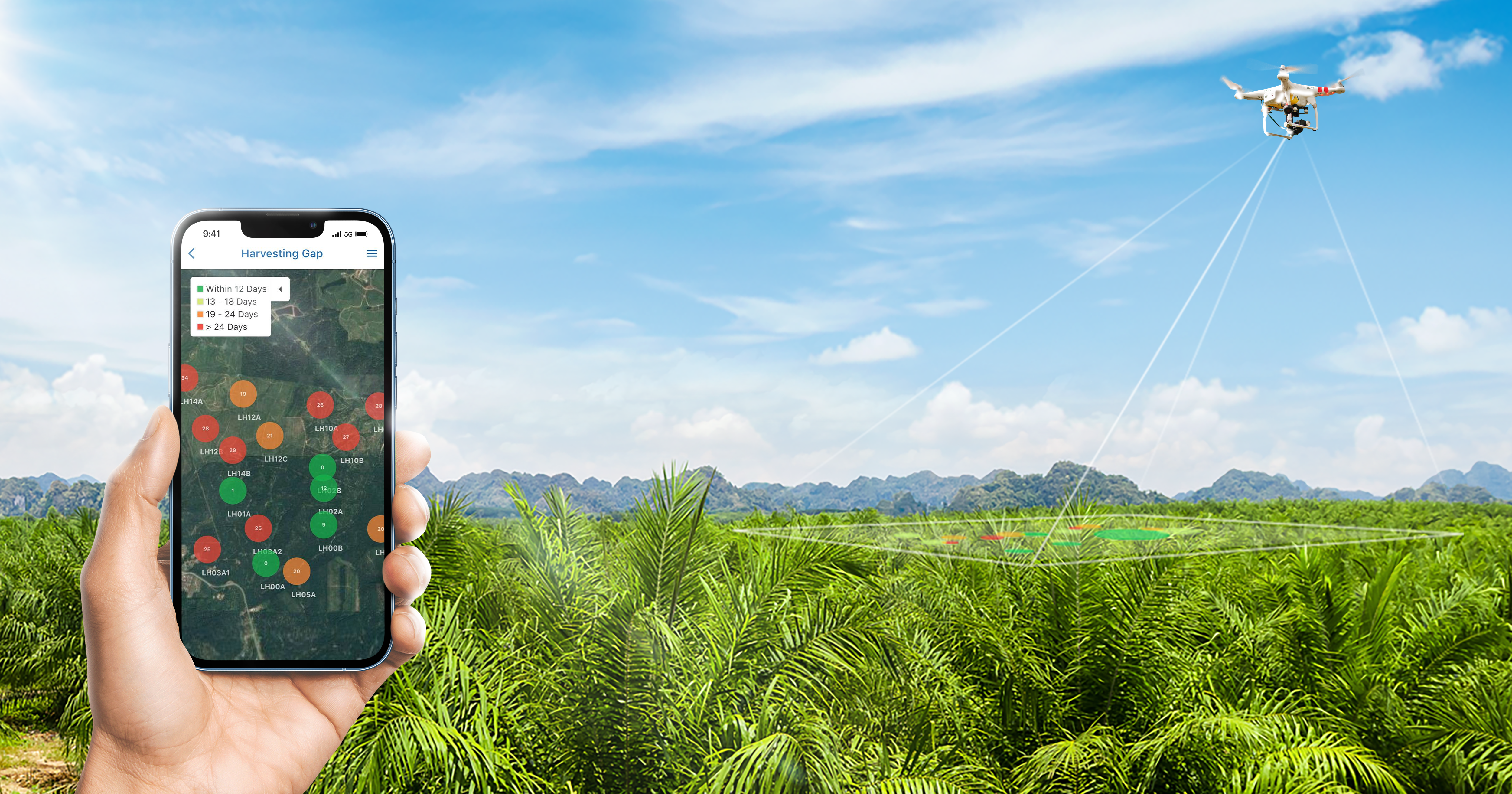
lead PRODUCTION WITH Location data tools
Geo-locate points of interest for optimised tracking and overview of plantation and production processes. Combined with advanced filtering, merge or separate data according to specific times, area, and locality for current, clean and clear visual informatics.